
Using Bing Maps
Bentley has introduced an option to attach a Bing map as a raster reference. If you have a lengthy project or need to attach many aerial photos, using the Bing map might be a better option.
Since the Bing Map would most likely need to be cropped for any drawing it is used on, it is best to attach it as a reference to the project's raster image drawing and then attach the raster drawing to the one being worked on clipping the reference attachment to the desired limits.
Attach the Bing Map to the Raster Drawing
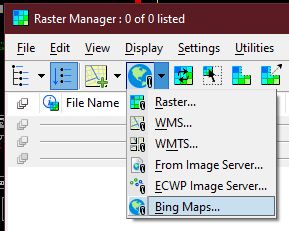
Attach the Bing Map to the Aerial model of the 12345raster drawing using the Bing Maps... option of the Attach tool.
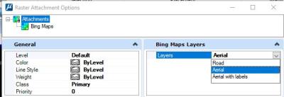
When presented with the attachment options, change the Layers property to Aerial if it isn't already set.
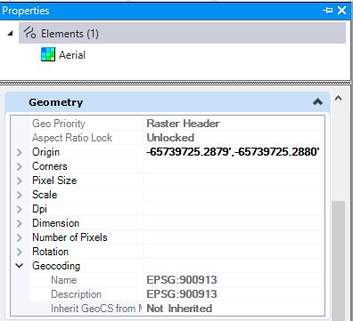
If the map does not appear to be in the proper location, select the Bing Maps attachment in the Raster Manager and check its properties.
Look for the Geometry section and expand the Geocoding properties. Confirm that Inherit GeoCS is set to Not Inherited.